
 Munzir Hakimi
Table of Contents
Introduction
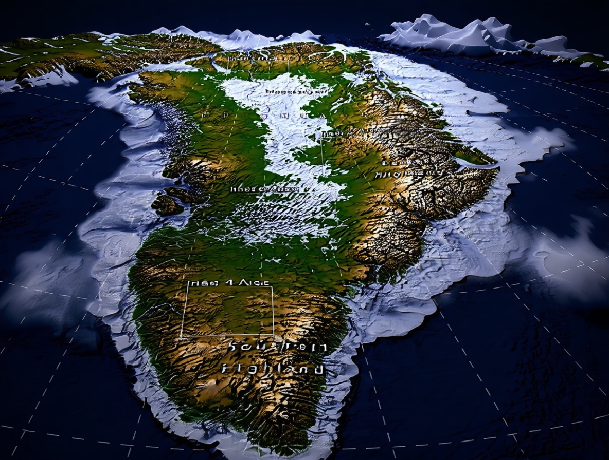
Maps feel solid, but Greenland’s ice is hiding hundreds of valleys that older maps missed or left in pieces. That hidden ground can make the world feel less certain. That is a strange feeling, like a familiar room with doors you never noticed.
Now mappers can trace those valleys as one linked terrain. If you use maps, that can mean less time checking gaps and a clearer path to decisions. And mapmakers can compare one linked network instead of scattered fragments, changing how they spot missing links beneath the ice. It is a quiet shift, but it can change how we trust the ground under our feet.
Hidden Valleys Linked Under Greenland’s Ice
Imagine trusting a map of Greenland, then learning that hundreds of valleys are hiding quietly beneath its thick ice, like rooms you never knew were there and cannot see. Older maps missed many of those valleys, or they showed only broken pieces that did not connect into a whole picture you could follow, so the ground stayed a puzzle. That gap can make the ground feel strangely unfinished and hard to picture clearly in your mind.
Now mappers can trace those hidden valleys as one linked terrain under the ice, not as separate clues. Instead of a scatter of fragments, they can follow a single connected shape from one end to another. That shift brings relief, because a linked landscape is easier to trust when you need a clear picture of what lies below the frozen surface.
Why should that matter in everyday life, even if you never visit Greenland? A connected terrain lets you picture what is down there as a whole, not as a bunch of missing bits that keep you guessing. You get less guesswork and a clearer view of the ground beneath the ice, which can make the hidden landscape feel less like a mystery.
A Linked Map Means Fewer Gaps To Check
Have you ever used a map with blank spots and wondered if you missed something important? For map users, fragmented valleys create that exact feeling, and you spend extra time checking gaps because the pieces do not line up in a way you can trust, and it steals focus you could use for something better. The patchwork slows you down and wears you out.
A linked map may change that by reducing the patchwork you have to work around. It can help you stop jumping from one broken piece to another just to fill in missing parts, so you can look at one smoother view instead of a dozen tiny questions. That saves time and lowers doubt, because the map stops feeling like a puzzle with missing pieces.
Why should you care about that? Clearer terrain decisions become possible when the ground looks more connected and less chopped up. You can choose a path, plan a project, or understand a landscape with less second-guessing, and that confidence matters when you are trying to make a real choice about land. A smoother map helps you move with confidence, and you do not have to keep rechecking the same gap over and over.
Spotting Missing Links In One Linked Network
Mapmakers used to stare at scattered valley pieces and guess how they might fit together, like solving a puzzle with no box. Now they can compare one linked network beneath Greenland’s ice, not a pile of disconnected fragments that leave big questions. That changes the moment they spot a missing link, because the missing part has a clear home. It is a small change with a big effect on how they see the ice.
Instead of disconnected fragments, they see a whole pattern with a shape they can follow from one side to the other. A gap stands out more clearly, because it has a place in the larger picture and a relationship to nearby parts. That helps them notice what is missing without getting lost in separate scraps. That small shift matters more than it sounds.
Why should you care about how mapmakers work? When they spot missing links, the maps they build can become more coherent and less confusing for everyone who uses them. That means anyone who later relies on those maps gets a clearer view of the ground beneath the ice, even if they never meet the mapmaker, and a better network can lead to better understanding that shapes choices. It can change what they choose to study next.
Conclusion

Mapmakers now have one linked network to compare, not a crowd of disconnected valley fragments. That changes how they spot missing links beneath Greenland’s ice. Seeing the whole shape makes the missing parts stand out. It turns a scattered mystery into a connected question.
There is wonder in that shift. A mapmaker no longer has to chase scraps and wonder if something important slipped away. They can look at the linked network and ask where a link should be. That kind of clarity can change how they work. You can borrow that hope, because seeing the whole helps you notice what is missing.
What do you think? Does knowing Earth’s “delivery story” change how you feel when you look at the stars?